Interactive Route Map
As a driver, you can now interact with a route map for each of your route tiers to help you learn your routes, stops and the surrounding roads. This interactive map can be access from two places:
1. Before you drive your routes from the driver welcome screen
2. From the "Routes" page, while you are on route and your bus is not moving
Here's how it works..

What's new?


Anytime you're on a a bus route, you can view your current route tier's map by tapping 'Routes'


Then tap 'View route map' at the bottom of the stop list

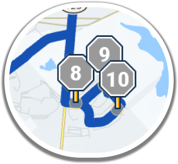
Each of your stops is shown on the map, along with your designated route path, in blue.
You can zoom in/out of the map to get a better look at your route path and stops
Turn by Turn Drive Mode must be enabled by your transportation staff for your route tier before you utlize it
i
i
Another new tool we've added for drivers is the "Go" button
Anytime you're on route, you can get Turn by Turn navigation instructions to any of your bus stops
Tap "Go" for the stop you'd like directions to

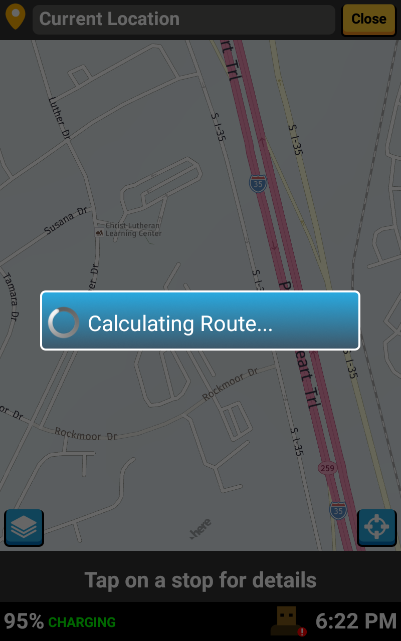
The driver app will calculate the quickest route path from your current location

Then tap 'View route map' at the bottom of the stop list
Then tap 'View route map' at the bottom of the stop list


..shown here. This lets you from a 'Street' map, to a 'Satellite' map to get a different look at landmarks for your route

You can tap this layers icon here, to toggle on the 'Map Details' window..

..and you can also choose to show Entrance/Exit Points for each of your stops, as well as Passthroughs, and Hazard Areas

That's it!
Head back to the tutorials page to learn about the other new Driver App features coming in Fall 2021